
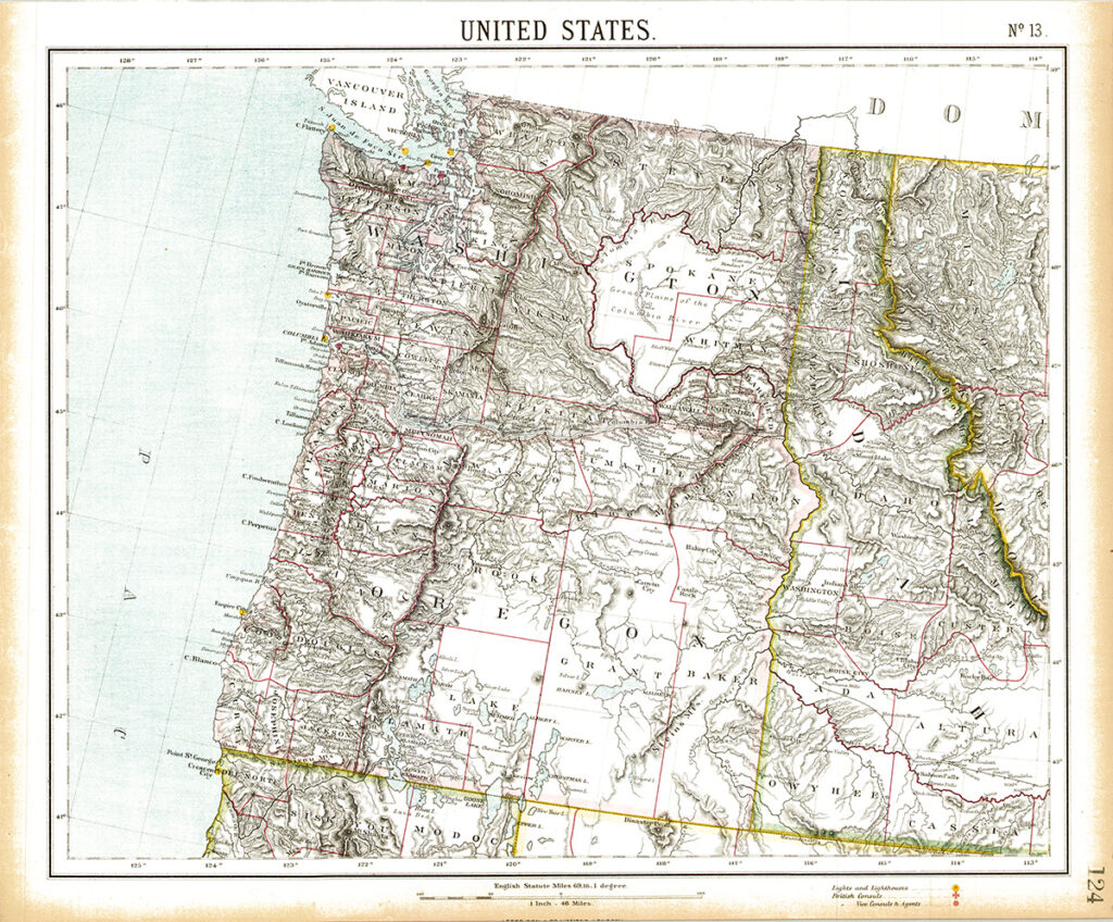
This is my newest antique map that I bought from a dealer in the U.K. Right away I liked it because of the details in the mountain topography . Although its doesn’t have the same full coloring like the Crams Atlases made in the U.S. during the same time, the lines and shading of the mountain ranges really pops off the page giving it a three-dimentional look. The map was published in 1889, the same year that Washington joined the union.
Even though the map was published in 1889, if you look at the map closely it still shows the border of the Oregon Territory. It does not show the boundaries of Oregon and Washington State. What does all this mean? Back then creating maps was an expensive task so map publishers would often use the same map for multiple years.