Skip to content

SteveCarroll.net

Antiques, Local History and Outdoor Adventures

  • Local History
  • Weird but True
  • Outdoor Adventures
  • Antiques
  • About Steve
  • Subscribe
SteveCarroll.net

Tag: maps

Map of Oregon in 1859

Oregon Joins the Union: Map of Oregon from 1859 Colton’s Atlas

March 17, 2022 Steve Carroll Antiques, Local History

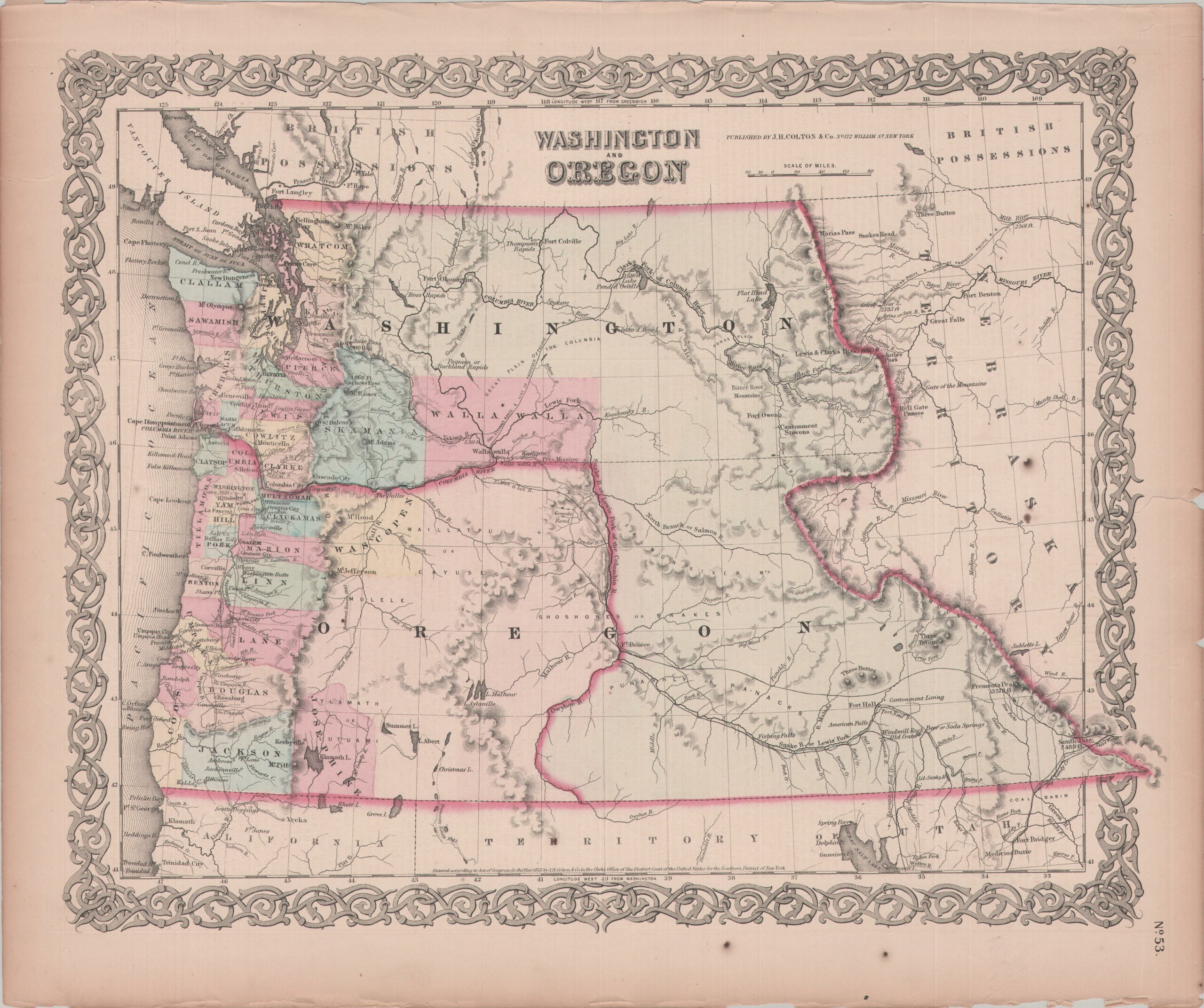
This map of the State of Oregon and the Washington Territory is from the 1859 edition of Colton’s Atlas and[…]

Read more

Recent Posts

  • 1939-S Oregon Trail Memorial Half Dollar
  • 1893 Columbian Expo “Pre-Official” Postal Card, Fisheries Bldg
  • Vancouver’s Hanging Holiday
  • Haunted Walking Tours of Vancouver
  • Vancouver and the Great Flood of 1894

Recent Comments

  1. Julie on Vancouver’s Hanging Holiday
  2. Jan on Forgotten Portland: Council Crest Amusement Park
  3. Bob Stephens on Forgotten Portland: Council Crest Amusement Park
  4. Pauline on Forgotten Portland: Council Crest Amusement Park
  5. MaryAnn Borcherding on Forgotten Portland: Council Crest Amusement Park

Blogroll

  • The Oregonian Archives
  • Clark County Historical Museum
  • Fat Man Caving
  • National Register of Historic Places listings in Clark County
WordPress Theme: Poseidon by ThemeZee.